
House coordinates | Geodata
House coordinates describe the location of all 28 million buildings throughout Germany based on their X-Y geocoordinate and the correct postal address. They are used by numerous companies as the basis for geomarketing measures - for example, by publishers for logistics optimization, energy and telecommunications providers for network planning, and navigation systems for precise guidance to a house. They are also used on a daily basis in the real estate industry, by public authorities and security services (e.g. the police), as well as in administration, science and research.
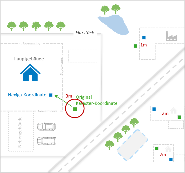
The data is available for all levels of location accuracy: from the official house coordinates of the national survey to interpolated house coordinates based on data from Telecom, TomTom or OpenStreetMap. OpenStreetMap is a free project that collects geodata that can be freely used by everyone (Open Data). With the help of this data, world maps can be calculated or special maps can be derived and navigation can be operated.
Information & features
All descriptive features from the Nexiga Building database are available for each of our house coordinates.
House coordinates contain the following information:
-
X-Y coordinate: in all common projections and geographical reference systems
-
Quality information on the geocoordinate
-
Geo code for country, Administrative district, County/district-free city, Municipality, district or municipality, street, Building
-
Address contents: Street name, house number, address addition, Postal code, postal place name, addition to postal place name, postal district