Borderless with international data
Making the right decisions worldwide.
Cross-border market and geodata, successful without borders
Globalization demands a reliable international data offering and Nexiga has a diverse range of in-depth market data and geodata available internationally. Location intelligence at a wide range of territorial levels (zip code level, administrative level, fine-grained territorial levels) provide you with detailed decision-making bases for the evaluation of real estate, locations and distribution networks, as well as for target group analyses and territory optimization, and this across borders.
Zooming, defining sections, displaying distances, printing - our digital vector data (Nexiga Geostreet+) makes everything possible. This way you have all regional conditions in view and can easily and quickly compare the results of geographic analyses.
Our special data in combination with basic socio-demographic data round off Nexiga's portfolio of international data.
- Plan locations in other countries safely and efficiently.
- Precisely compare areas and locations across countries.
- Create detailed maps of regions or countries.
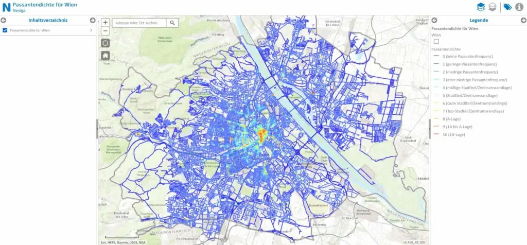
- Analyze frequencies of vehicles, pedestrians, and public transport with street-segment accuracy.
Pedestrian frequency (PFA) Europe
Consumer Focus Index (KSI)
The Consumer Focus Index (KSI) provides a valuable basis for objective location and expansion planning. It combines parameters such as retail density and pedestrian frequency and thus clearly reveals focal points of consumption.
In this way, even small-scale areas and street sections can be precisely evaluated and purchasing behavior analyzed. Indispensable for the evaluation of location quality and centrality!
Traffic data worldwide
How much traffic is on which road? With our worldwide traffic data you will find out!
They are based on historical data from traffic databases in combination with permanently updated, anonymously collected real data.
The perfect basis for location planning, route calculations and much more.
Digital maps for everyone available worldwide
Zooming, defining sections, displaying distances, printing - our digital vector data (Nexiga Geostreet+) makes everything possible.
This way, you have all regional conditions in view and can easily and quickly compare the results of geographic analyses.
Digital boundaries and sociodemo-graphic characteristics
Nexiga has a diverse international offering of in-depth market data and geospatial data at a wide range of territorial levels (zip code level, administrative level, fine-grained territorial levels).
Use this valuable data to better understand customers, identify markets, and leverage potential - internationally.


