By linking existing data with additional data, valuable insights can be gained. Data enrichment thus provides the appropriate context between this data and new insights can be derived from it. If the spatial location is also involved, we speak of geoenrichment.
A common principle, as even the ancient Romans knew how fertile the land of individual farmers in the provinces was. And they did this by linking the "addresses" of the time with geographical data (soil composition, groundwater resources, etc.). With the Nexiga Geoenrichment Server, this would definitely be more convenient today. We present the use cases.

Example: Geodata for the insurance industry
In the insurance industry, risks have long been analyzed and evaluated geographically. For example, car insurance is cheaper in counties where statistically few accidents occur than elsewhere. In practice, of course, many more factors play a role in calculating rates. These are primarily the individual characteristics of the customers themselves, as well as vehicle age and type, motorization and - at least according to rumors - even the vehicle color. The characteristics are considered in relation to the respective region. Technically, the customer addresses are linked to the district or independent city. This is done using a district key , which we at Nexiga call KGS5 (because of its 5 digits). Similarly, there is the 8-digit KGS8 for municipalities, the KGS22 for the Nexiga residential quarters and the KGS36 for the Nexiga road sections (both with only 14 digits, however, which is sufficient).
Geographical environment data plays a key role in risk assessment, particularly in the case of household contents insurance - keyword burglary and theft. However, the relatively coarse breakdown by district is not very useful here; more important is more detailed data at zip code or district level, or even better, more detailed data for neighborhoods (such as residential areas), Micro postal code or even for individual road sections.
Convenient (geo) data enrichment for addresses
Building addresses are used to clearly identify the location of a building. Addresses have been around for a long time, initially consisting only of place names. In remote areas, this is still the case today. However, as settlements grew, street names or at least place names were added. House numbers were not introduced nationwide until the 18th century. Nowadays, depending on the country, region or cultural area, there are some peculiarities and curiosities.
The process of georeferencing (by geocoding) is generally understood to be the assignment of spatial information to addresses, in the simplest case with coordinates. With the Nexiga Geoenrichment Server*, (geocoded) address data can be quickly and easily enriched with additional data. By enriching it with geo-keys, addresses can be linked to a wide variety of market data, related to other spatial objects and used for a wide range of analyses.
*The Nexiga Geoenrichment Server is a client-server system whose functionality is available via interfaces and a web client (= Internet browser). Access to the application is via the Nexiga Portal, a platform via which various Nexiga apps are available, provided they are licensed by the customer.
Use cases for data enrichment
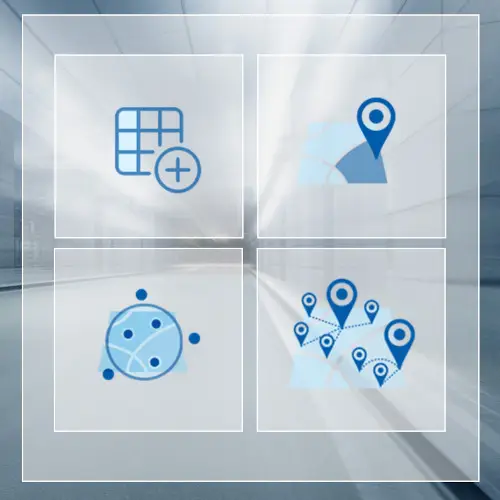
Four different use cases are available via the Nexiga Geoenrichment Server, with which data can be enriched:
-
Point in polygon

Addresses that are already provided with a coordinate pair (through geocoding) are enriched with additional data based on the spatial location. -
Link via key fields

Addresses that are already provided with geo-keys (through geocoding) are enriched with additional data by means of a join via corresponding key fields.
-
Aggregates in the vicinity

Addresses that are already provided with a coordinate pair (through geocoding) are enriched with aggregated data in relation to a defined radius based on the spatial location. -
Next objects

The nearest objects are assigned to addresses that are already provided with a coordinate pair (by geocoding) based on the spatial position.
Use case "Nearest objects"
This use case should be interesting for the real estate industry, for example. Every search for an apartment or a Building is always associated with a list of location factors. These can be very individual, but often similar criteria apply to many buyers or tenants in the area surrounding their own four walls. Very few people like living right next to a highway. But it shouldn't be too far away. How long does it take to drive to the nearest highway exit, how far is the nearest train or subway station? Such information can be enriched for any address via the Geoenrichment Server. The residential location of a property can thus be better described.
The REST is yet to come
One more thing: With the Nexiga Geoenrichment Server, it is also possible to address addresses via an API (programming interface), whereby information can be played directly to addresses in the background.
Services can be requested from another program or operating system via the API (Application Programming Interface). A REST (Representational State Transfer) interface is primarily used by web browsers for web services and has the ability to process several types of requests and return different data formats.
Would you like to find out more about our modern web technology?
