
Donut villages: vacancy or growth
Vacancy in the center, growth on the outskirts Do you live in a "doughnut village"? This term describes rural villages or suburbs in which the town centers are increasingly being replaced by

Vacancy in the center, growth on the outskirts Do you live in a "doughnut village"? This term describes rural villages or suburbs in which the town centers are increasingly being replaced by
With approx. 520,000 Topshops addresses from almost 1,300 chain stores, Nexiga's Point of Sales database is unique in Germany. This makes the determination of sales hotspots reliable and facilitates meaningful location and competition analysis for any location.

Or to put it geographically: where darkness makes more thieves... Over the past four years, the number of domestic burglaries in Germany has changed considerably. Especially in the
Although local authorities already have a lot of data, it is often fragmented, incomplete or in incompatible formats. This is why they are sometimes supported externally with tools and high-quality data sets in the necessary processes. For example, building data such as year of construction, living space or heating age is used to create digital twins of the municipalities that replicate physical reality and simulate scenarios.

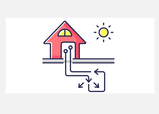
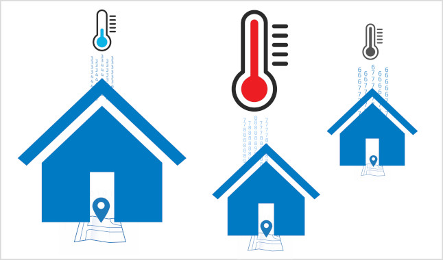
Industry is the largest energy consumer in Germany, but private households are right behind. They use the majority of their energy to heat apartments and houses. Despite improved insulation in recent decades, energy demand continues to rise as living space increases.
Efficient energy planning can be supported by the Nexiga heat demand map, which shows the heat demand in detail down to street level.
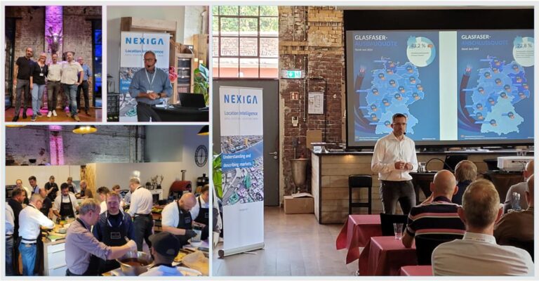
5th Telecommunications 2024 Competence Talk The telecommunications industry is currently facing considerable challenges, including falling investor funds and declining expansion figures in the fiber optic network sector (HomesPassed). Nevertheless, modern

Last Sunday was the state election in Saxony-Anhalt, for many a barometer of mood for the federal election in September. The election results were also observed in faraway countries: Thus, in the ticker reports of the Bloomberg TV stock exchange channel from New York City, the news appeared late Sunday evening that elections were held in the poorest Federal state ("poorest state") of Germany. Is that so? What does the Nexiga purchasing power data say about this?

Last Sunday was the state election in Saxony-Anhalt, for many a barometer of mood for the federal election in September. The election results were also observed in faraway countries: Thus, in the ticker reports of the Bloomberg TV stock exchange channel from New York City, the news appeared late Sunday evening that elections were held in the poorest Federal state ("poorest state") of Germany. Is that so? What does the Nexiga purchasing power data say about this?

Everything to do with Building, has been available from Nexiga for four decades. Since the 1980s, the Building has been the subject of area-specific investigations. It is the factual basis for the data and analysis world and has already delivered successful results to many planning and evaluations.
You are currently viewing a placeholder content from Vimeo. To access the actual content, click the button below. Please note that doing so will share data with third-party providers.
More InformationYou are currently viewing a placeholder content from YouTube. To access the actual content, click the button below. Please note that doing so will share data with third-party providers.
More InformationYou need to load content from reCAPTCHA to submit the form. Please note that doing so will share data with third-party providers.
More InformationYou are currently viewing placeholder content from HubSpot Embedded Content. To access the actual content, click the button below. Please note that doing so will result in data being shared with third-party providers.
More InformationYou are currently viewing a placeholder content from HubSpot. To access the actual content, click the button below. Please note that doing so will share data with third-party providers.
More InformationYou are currently viewing placeholder content from HubSpot Meetings. To access the actual content, click the button below. Please note that doing so will result in data being shared with third-party providers.
More Information