Under this motto the Esri Conference took place simultaneously in three cities this year. Numerous GIS users and interested people met in Bonn, Zurich and Vienna to exchange information about the innovations of the ArcGIS technology.
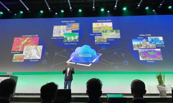
The digital twin in particular played a major role in the event, which was divided into various "twin topic tracks" such as Governmental, Urban, Infrastructure, Environmental and Business , which were presented in exciting topic and tech sessions on the first day of the event.
The Autobahn GmbH of the Federal Government used the example of the Infrastructure Twin to show how modern infrastructure management works today using GIS and BIM solutions . Further insights were also provided by Westnest GmbH, which used the Digital Twin and corresponding GIS technology last year to document the power infrastructure in flooded areas and to restore it just as quickly.
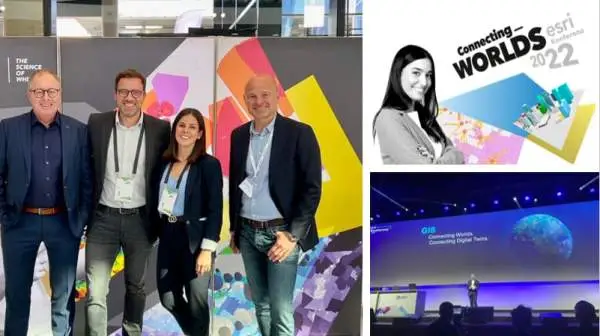
Jürgen Schomakers, Managing Director of Esri Germany and Esri Switzerland welcomed the GIS community together with moderator Daniel Finger on the first day of the fair in Bonn. The insights into the work of the keynote speakers with ArcGIS showed the respective digital twin, which was created and analyzed with the help of the extensive tools and possibilities that ArcGIS offers.
Communication between real and virtual object
In addition to the exchange with customers and partners, the four parallel running topic tracks on Governmental Twin, Urban Twin, Infrastructure Twin and Business Twin on the first day of the event were constant companions in the application of ArcGIS technology, which enables objects, processes and phenomena of the real world to be digitally mapped and analyzed in detail with intelligent tools and functions.
Environmental Twin
The Tech Plenary, which opened the second day of the conference, focused on the environment and sustainability and showed the potential of the Environmental Twin as an image of our earth. Nils Sparwasser from the German Aerospace Center (DLR) and Gabriele Dederer from WWF talked about the impact humans have on the environment and nature and how Esri technology can be used innovatively to protect them.
The Earth as a digital twin (Environmental Twin), created from numerous data sets, information from remote sensing data and radar satellites to weather satellites. Sparwasser shows how this information has been gradually reconciled and assembled to present both the beauty and the human impact on the health of our planet.
Numerous tech sessions in the afternoon enabled the visitors to get to know the latest developments of the ArcGIS products, among others the latest versions ArcGIS Pro 3.0 and ArcGIS Enterprise 11 and to inform themselves about the different apps and applications like ArcGIS Urban and Indoors.
Please enter the password recap1 to watch the video.
Meet us live this year at the Map Apps Days in Münster, November 07 and 08.
Networking and personal exchange with customers and partners is still irreplaceable.
We are looking forward to it!