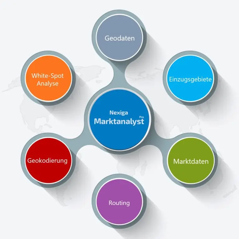
Nexiga Marktanalyst Pro is the professional desktop solution for spatial GIS applications for perfect processing of geomarketing or location intelligence issues, (geo) data with a geographic information system.
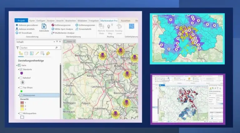
The basic software ArcMap (ArcGIS Desktop by Esri) used for this purpose so far will finally be converted to ArcGIS Pro this year after a longer transition phase. In addition to Nexiga's detailed data, ArcGIS Pro's extensive features add new essential core functionality to Nexiga's Marktanalyst solution. Nexiga Marktanalyst Pro offers important core functions for geocoding addresses, for spatial analysis (e.g. white spot analysis), for calculating spatial score values (multi-criteria analysis) and for calculating catchment areas. In addition, there is the possibility of area planning. In addition, the geocoding and routing functions will in future be based by default on online services provided by connection to our Nexiga portal.

Useful functions
- Geocoding: visualize customers, recognize spatial patterns.
- White spot analyses: discovering areas of potential.
- Multi-criteria analysis: evaluate spatial units, locate sales opportunities.
- Find target groups: Identify areas with high affinity.
- Territory planning: Optimized sales territories, assign sales force employees.
Nexiga is a Gold Partner of Esri and an official reseller for Esri software products.
Nexiga Market Analyst Pro Showcase
In order to better understand the changes and benefits, we refer here to our webinar on 28.02.2023.
Here you will learn, among other things, how the Nexiga Marktanalyst Pro can be used in particular for company-wide site planning. Using concrete use cases, we show you how these work and help you to make better decisions. In addition, we will compactly list where the differences between ArcGIS Pro and ArcMap lie.
Practical application of a location planning
Are you planning a new, attractive location? Or do you want to know where the greatest customer potential for your sales is located? With Nexiga Marktanalyst Pro, you can quickly and easily discover white spot areas or determine your customer and sales potential in the catchment area across different distance zones.
The starting point is often the geocoding of addresses: What is the spatial distribution of customers or prospects, are there geographical patterns to be discovered? By importing address lists into the system, these are first validated (checked and possibly corrected), then enriched with Nexiga coordinates and Nexiga geocodes and displayed directly on the map for further analysis. Likewise, the address data can be spatially aggregated to visualize, for example, customer density or market penetration per territorial unit.
In addition, the store network can be reviewed and optimized: Locations, or points of interest in general, almost always exert an attraction on their surroundings, depending on their importance both on a small scale (e.g., bakery) and on a large scale (e.g., furniture store). As distance increases, the attractiveness of locations decreases. The farther an area is from the nearest location, the less it is served by the location in terms of coverage and accessibility. However, if there is a high potential there, spatially possible gaps in the existing store network can be discovered. These are white spot areas which can be analyzed as part of expansion planning.
Further, potential areas can be discovered: Where can lucrative target areas for marketing measures be found, taking into account market data such as purchasing power or product affinity? Which areas offer the best sales opportunities for a product or service? A multi-criteria analysis evaluates spatial units (e.g. Zip code areas or residential quarters) by combining several criteria (market data), optionally with different weighting. The score value determined shows in which areas a favorable combination of success factors (KPI) are present. As an example, for the sales of a product, the proportion of the population over 65 and the purchasing power per inhabitant can be considered in combination. The spatial units (e.g. Nexiga Micro postal code) are displayed in the map classified by the level of the score and a ranking is created.
These are just a few examples of the extensive analysis options.
Switch - ArcGIS Pro is the new ArcMap
ArcGIS Pro is the new powerful 64-bit desktop GIS from our technology partner Esri. The software package has developed rapidly in recent years and will completely replace the still widely used ArcMap at Nexiga in 2023. Technological focal points are the creation of professional maps in 2D and 3D as well as overall improved data management.

In addition to the modern software architecture, ArcGIS Pro is more closely connected to the ArcGIS platform than ArcMap. This offers some advantages, because with ArcGIS Pro you get access to a whole range of apps, new tools and also seamless access to data in the Esri cloud. So Nexiga data is also available for retrieval online. Likewise, ArcGIS Pro licenses are now managed via ArcGIS Online by default.
ArcGIS Pro and ArcGIS Online are part of the Esri Geospatial Cloud. With Software as a Service (SaaS), maps and data can be shared over the web with different groups, companies or organizations, or with all Internet users.
Nexiga Marktanalyst Pro as a complete solution
The main advantage of NexigaMarktanalyst Pro is the ability to use the multi-layered geodata and market data for a wide range of questions and industries. This enables companies from the retail, energy, telecommunications, real estate, finance or manufacturing sectors, as well as sales organizations from other segments, to usefully supplement their data portfolio with additional important analysis indicators.
In combination with the already existing functions of ArcGIS Pro, the Nexiga Marktanalyst Pro reproduces all known functions of the previous desktop variant (for ArcMap).

