Territory planning - proceeding unerringly
Reach customers faster, easier and more efficiently.
Plan areas safely, the goal is the right way!
Recognize the connections - with digital maps and a flexible geoinformation system!
By storing relevant data over a wide area, you can optimally evaluate and even reorganize all geographical levels: Counties, municipalities, postal codes, statistical districts, fine-grained residential and postal quarters down to individual buildings.
More transparency for sales territories and sales regions:
- You will know where your customers live and how best to reach them!
- You will know how to run the perfect routes!
- You will know which addresses have to be addressed in which order!
Because all this is already in your data. You just need to decode it - with the right sales territory planning tool. Our Nexiga market analyst can also be optimally adapted to your wishes.

On the efficient tour!
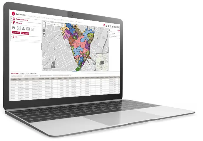
With the GIS solution and map-based territory planning created by Nexiga, DPD was able to perfect its parcel delivery. You can do that too!
Good to have a good plan
To achieve all your goals quickly and efficiently, you need to know where to go. This is especially true when it comes to sales territory planning - because here, above all, it's about finding the optimal route to customers, branches or partners.
Starting point for sensible planning of routes, sales territories or sales regions:
- A precise representation of geographic features based on postal or official data.
- Precise maps with detailed infrastructure data, the latest residential and commercial areas, geographical phenomena, all routes and, of course, all barriers.
To do this, you need comprehensive and reliable geodata that provide you with accurate information about your target groups in the area, as well as your prospects', customers' and employees' addresses - in other words, the potential stops on your tours.
This gives you a powerful basis for your route planning. Find your way to us now.

reach customers faster, easier and reach them more efficiently.
This use case shows you in a practical way how Nexiga's web-based territory planning was able to create a good driver experience for one of Europe's largest parcel delivery companies.
Questions about our solutions?
Do you need a results-oriented solution for your industry? Are you looking for specific data characteristics or would you like to receive more information? Then simply use our contact form. We are looking forward to your questions!
